| Sign In | Join Free | My frbiz.com |
|
| Sign In | Join Free | My frbiz.com |
|
| Categories | GNSS GPS Survey Equipment |
|---|---|
| Brand Name: | Wanggan |
| Model Number: | S2 |
| Place of Origin: | China |
| MOQ: | 2 |
| Price: | $70-$80 |
| Payment Terms: | T/T, Western Union, MoneyGram |
| Supply Ability: | 10000 sets/month |
| Delivery Time: | 10 working days |
| Packaging Details: | 19*15*9cm 0.4kg |
| Product name: | GNSS GPS Survey Equipment |
| Satellite signals:: | GPS GLONASS SBAS BeiDou |
| Use Range: | Agriculture, Pond, Outdoor explore etc |
| Use way: | handheld, machine load |
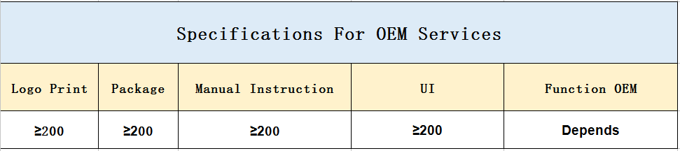
| OEM Service: | is Supported |
| Name: | GPS Land Area Measurement Device |
| Function: | gps land survey meter |
| Feature: | gps land area measurement |
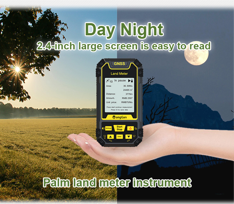
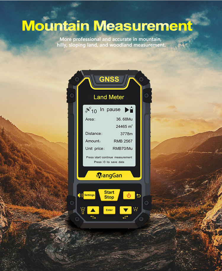
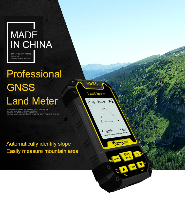
GPS Palm Land Meter Slope Mountain Flat Measuring GNSS GPS Survey Equipment
Fixed Point Area Measurement Of GNSS GPS Survey Equipment:
① In the main interface,press the ▲▼to switching function to“Fixed point”.
② At the land starting point,press the【Start】button to start measuring,and press the 【Enter】 button to confirm the information of the starting point.
③ Walk along the edge of the land,press the 【Enter】button at each inflection point to collect the information of each inflection point;
④ After collecting the information of the last inflection point (not coinciding with the starting point),press【Stop】button to pause the measurement and view the data.
⑤ If the measurement is not completed,press the【Start】button again to continue the measurement. If the measurement is completed,press "Stop" to save the data.
Note:
When using the fixed point function,two words of “fixed point ”will be displayed at the measurement interface.
When using the area measurement function,the measurement area icon will be displayed on the left side of the measurement interface.
When using the fixed width function,the words on the right side of the measurement interface represent the number of points collected.
Operation instructions of Distance measurement Of GNSS GPS Survey Equipment:
Normal distance measurement function
① In the main interface,press the【Start】button for 3 sec to measurement at the starting point.
② Walk along the measuring line to the end point and press the 【Stop】button to stop the measurement and view the measurement data;
③ If the measurement is not completed,press the【Start】button again to continue the measurement. If the measurement is completed,press "Stop" to save the data.
| Functions | S2 |
| Normal area measurement | √ |
| Fixed width area measurement | √ |
| Machine load area measurement | √ |
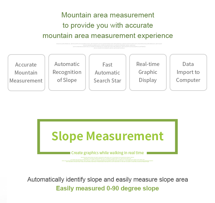
| Slope area measurement | √ |
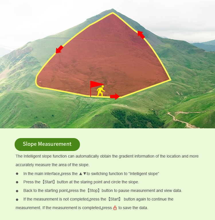
| Intell. Slope measurement | √ |
| Fixed point measurement | √ |
| L/W area measurement | √ |
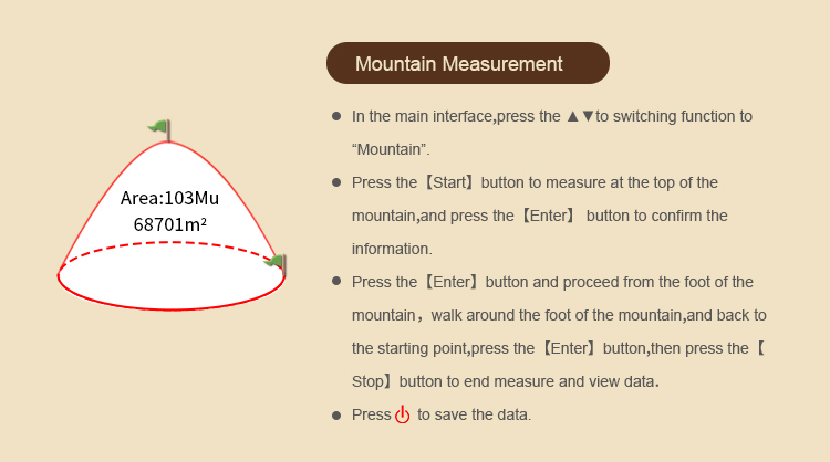
| Mountain area measurement | √ |
| Normal distance measurement | √ |
| Multipoint distance measurement | √ |
| Slope distance measurement | √ |
| Altitude display | √ |
| Altitude measurement | √ |
| Track display | √ |
| Real-time track | √ |
| Mu setting | √ |
| Unit setting | √ |
| Time display | √ |
| Data statistics | √ |
| Historical record | √ |
| Data export | √ |
| Car charger | √ |
| Lighting /Currency detection | √ |
| Voice broadcast | √ |
| Protection level | IP66 |


|
