| Sign In | Join Free | My frbiz.com |
|
| Sign In | Join Free | My frbiz.com |
|
| Categories | GPS Land Survey Equipment |
|---|---|
| Brand Name: | Wanggan |
| Model Number: | S4 |
| Place of Origin: | China |
| MOQ: | 2 |
| Price: | $76-$85 |
| Payment Terms: | T/T, Western Union, MoneyGram |
| Supply Ability: | 10000 sets/month |
| Delivery Time: | 10 working days |
| Packaging Details: | 19*15*9cm 0.4kg |
| Certification: | ISO9001 |
| Product type: | GPS Land Survey Equipment |
| Application: | GPS Land Surveying Device |
| Flat Measuring: | Support |
| Slope Mountain Measuring: | Support |
| Keyword: | GPS Land Measuring Tools |
| Warranty: | 12 Months |
| Satellite signals: | GPS GLONASS SBAS BeiDou |
| Slope Measuring: | Support |
| Voice broadcast: | Support |
| Used range: | flat slope and mountain terrain |
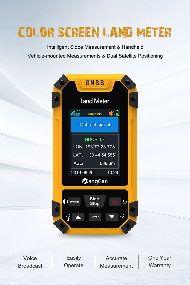
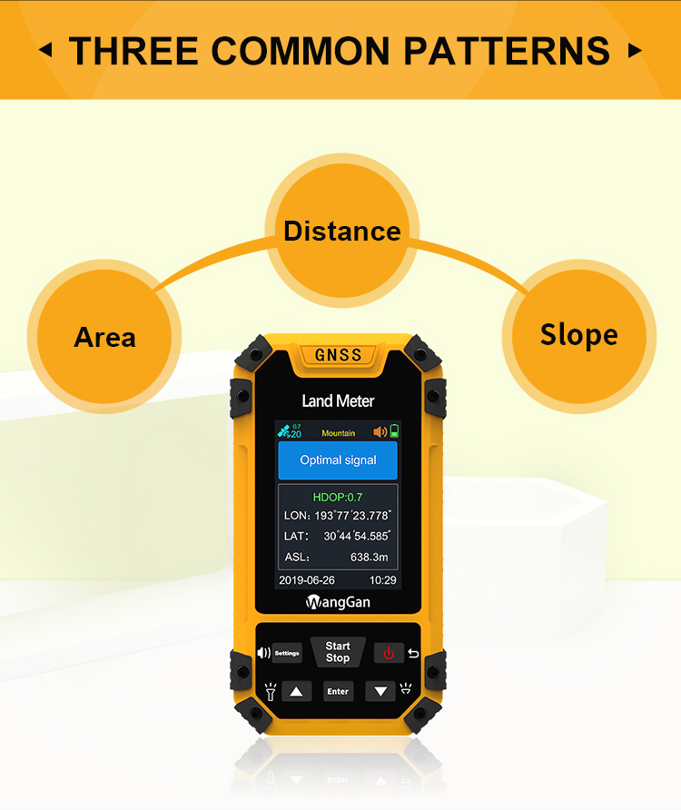
Irregular Terrain GPS Land Survey Equipment
Product Parameters Of GPS Land Survey Equipment:
| Receiver chip | High sensitivity GNSS receiver chip |
| Receiver antenna | Passive large-size planar antenna |
| Efficient startup | 1sec for warm boot, 30sec for cold boot. |
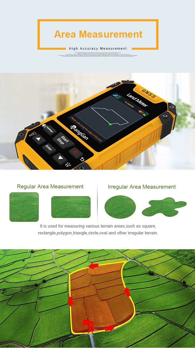
| Area accuracy | Measurement error within 0.03Mu(1-3Mu),2%(above 3Mu) |
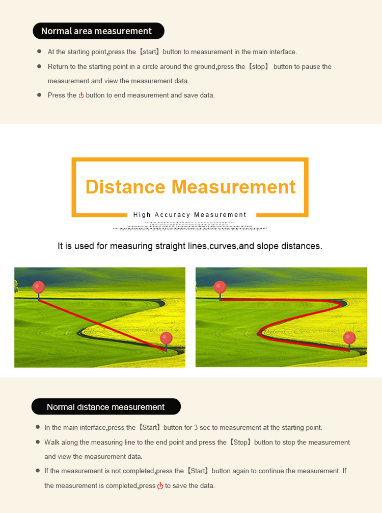
| Distance accuracy | Within 1m(HDOP less than 1.0,measuring 100m in length) |
| Function characteristics | Longitude and latitude display,altitude display,area measurement,distance measurement,land price calculation |
| Data statistics | Area statistics,distance statistics |
| Area record | 200pieces |
| Distance record | 200pieces |
| Track display | The track will be displayed in real time in the course of measurement,it can also be viewed in statistical records. |
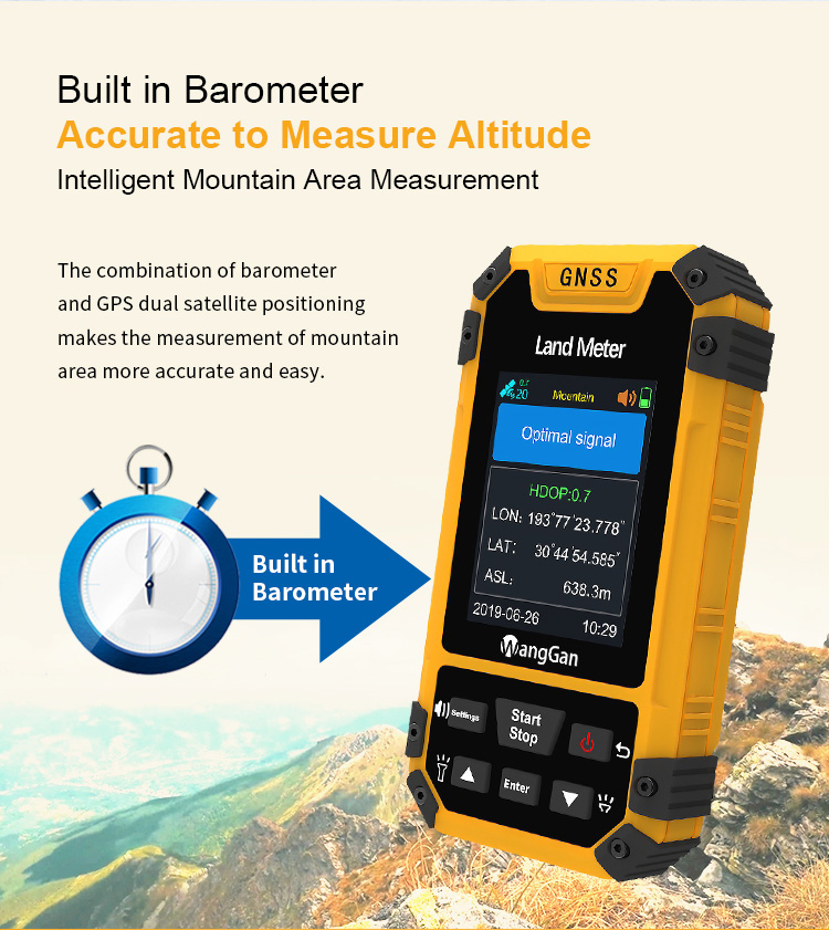
| Barometric leveling | About 1meter(Barometric measurement,the absolute altitude value needs to be calibrated) About 10meters(GPS measurement ,HDOP within 1.0) |
| HDOP setting | Custom HDOP setting |
| Screen display | Color screen(320*240) |
| Prompt tone | Voice broadcast |
| Working temperature | -20℃~65℃ |
| Storage temperature | -40℃~75℃ |
| Equipment size | 117mm×61mm×20mm |
| Equipment weight | 120g(No battery) |
| Data interface | USB interface,it can be charged through this interface |
| Standard configuration | Host 1,lithium battery 1,charger 1,data line 1,lanyard 1,instruction 1,warranty card 1,packaging box 1. |
Product function introduction of GPS land survey equipment:
| Model | S3 | S4 |
| Positioning accuracy | 2.5m | 2.5m |
| Initial barometric calibration | × | √ |
| Normal area measurement | √ | √ |
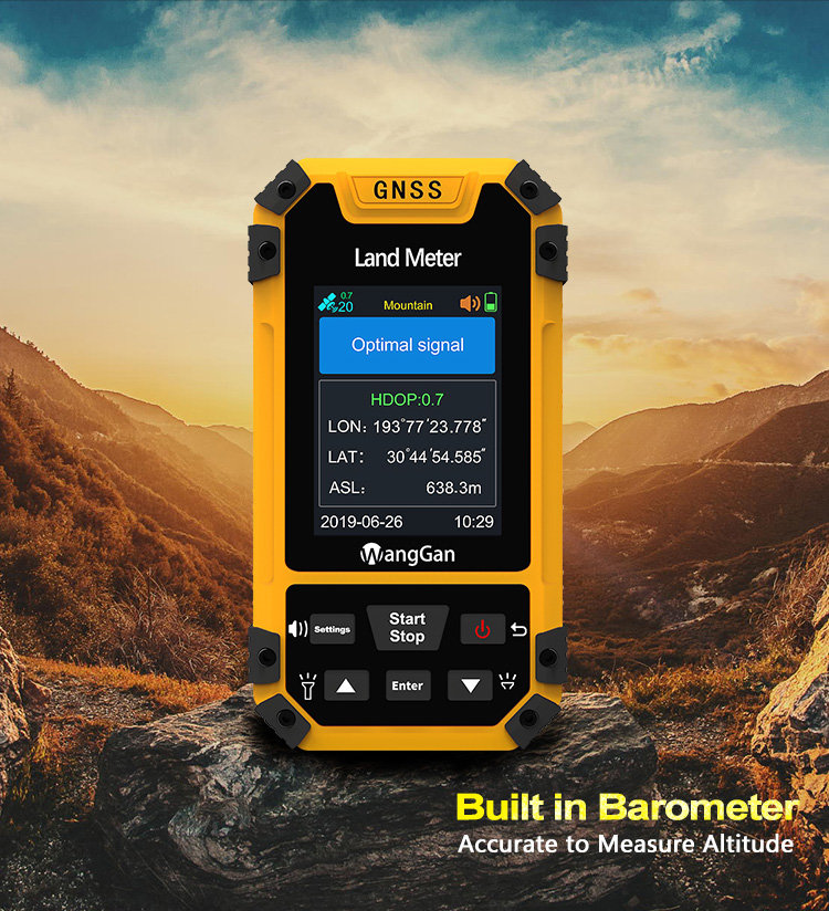
| Mountain area measurement | × | √ |
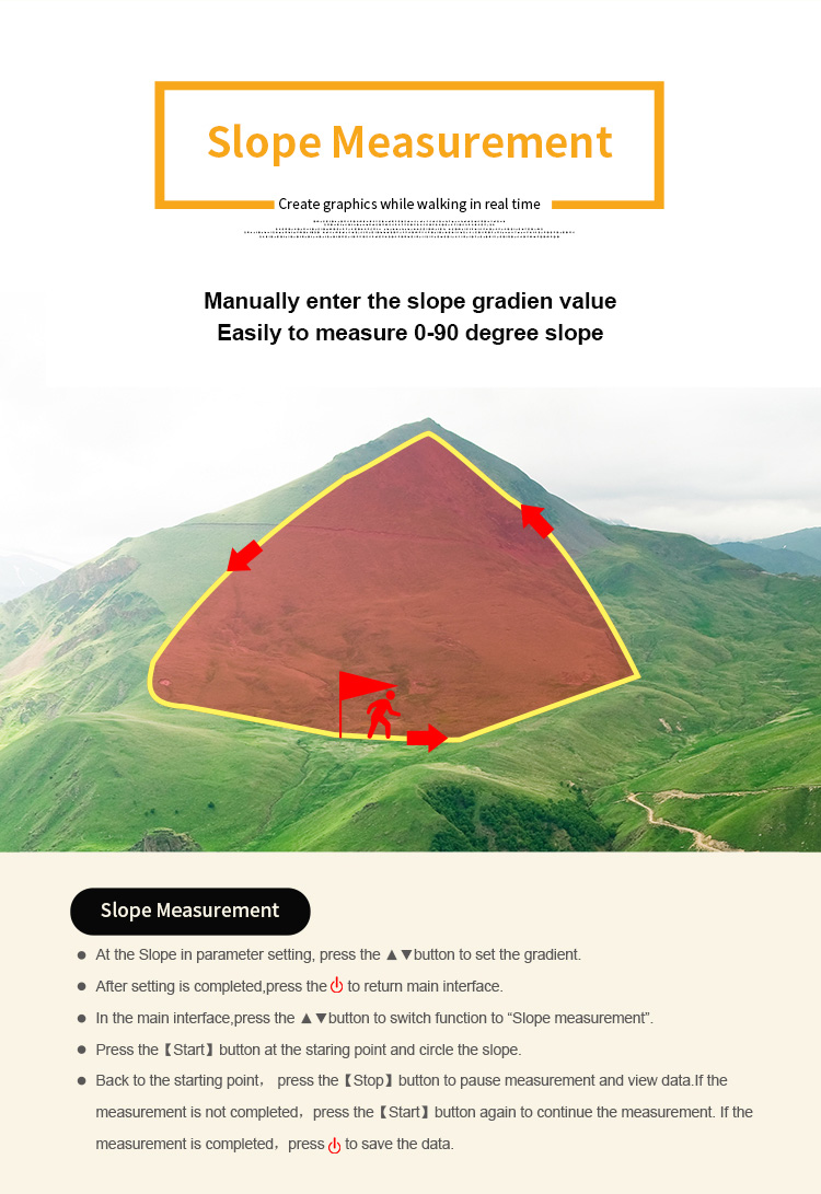
| Intell. Slope measurement | × | √ |
| Fixed point measurement | √ | √ |
| Fixed width area measurement | √ | √ |
| Normal distance measurement | √ | √ |
| Manual distance measurement | √ | √ |
| Altitude display | √ | √ |
| Altitude measurement | √ | √ |
| Track display | √ | √ |
| Mu setting | √ | √ |
| Unit setting | √ | √ |
| Time display | √ | √ |
| Data statistics | √ | √ |
| Historical record | √ | √ |
| Lighting /Currency detection | √ | √ |
| Dry battery | √ | √ |
| lithium battery | √ | √ |
| Data storage | 200 | 200 |
| Voice broadcast | √ | √ |
| Data export | × | √ |
Measuring Methods of GPS land survey equipment:
First, press up and down button to choose a measuring mode;
1. Normal mode : at the starting point, press [Start/Stop] button to measure in the main surface; return to the starting point in a circle around the
ground, press the [Start/Stop] button to pause the measurement data. Press the "power" button to end measurement and save data.
2. Normal distance mode:at the starting point, press [Start/Stop] button to start measuring ;Walk along the measuring line to the end point and
press the [Stop] button to stop the measurement and view the measurement data;If the measurement is not completed,press the[Start] button
again to continue the measurement. If the measurement is completed,press "power" button to save the data.
3. Multi-point mode:At the land starting point,press the up and down button switch function to “Multi-point Distance ”.Press the [Start] button to
start measuring.Then press the [Enter] button to collect the information of the points.Finally,press the [Stop] button to stop the measurement
and view the measurement data; If the measurement is completed,press "power" button to save the data.
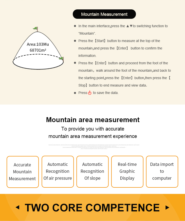
4. Mountain Mode : at the mountain top, press [Start/Stop] button to start measuring the mountain area.Now, it is the point A; Reach to the bottom
of the mountain, it is the point B. Press the [enter] button to save point B information; then walk around the bottom of the mountain, press
[enter] button when you finished. press the [Start/Stop] button to pause the measurement data, [start] to go on and press the "power" button to
end measurement and save data.
5. Intell Slope : at the starting point, press [Start/Stop] button to measure in the main surface; walk around the slope and press the [Start/Stop]
button when you finished. Press the [Start/Stop] button to pause the measurement. Press the "power" button to end measurement and save
data.
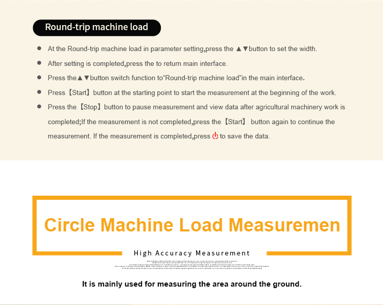
6. Round-trip Machine Load : In this mode, you could measure the area while the farm machine’s working. First, set the value number in
Parameter Round-trip setting. Then press [Start/Stop] button to start measuring while working. Press [Start/Stop] button to check when
working is done. Press [Start] to go on when it’s not finished. Press the "power" button to end measurement and save data.
7. Slope Mode : Set slope in Parameter setting before measuring. Then press [Start/Stop] button to measure in the main surface; walk around
the slope and press the [Start/Stop] button when you finished. Press the [Start/Stop] button to check the measurement data. Press the
"power" button to end measurement and save data.
System Setting Of GPS Land Survey Equipment:
Voice Volume:
① On the home page of boot,press the 【Settings】button to enter the settings interface;
② Press the▲▼button move to“System setting”;Press the【Enter】button to enter;
③ Press the【Enter】button to the voice volume;
④ Press ▲▼ button to adjust the value of number.
HDOP Limitation:
① On the home page of boot,press the 【Settings】button to enter the settings interface;
② Press the▲▼button move to“System setting”;Press the【Enter】button to enter;
③ Press the【Enter】button to the HDOP limitation ;
④ Press ▲▼ button to adjust the value of number;
⑤ After finishing setting,press the "Stop" button to exit.
Note: Measurements can only be made if the HDOP value is lower than or equal to the set value.


|
