| Sign In | Join Free | My frbiz.com |
|
| Sign In | Join Free | My frbiz.com |
|
| Categories | GPS Land Survey Equipment |
|---|---|
| Brand Name: | Wanggan |
| Model Number: | S8 |
| Place of Origin: | China |
| MOQ: | 2 |
| Price: | $70-$80 |
| Payment Terms: | T/T, Western Union, MoneyGram |
| Supply Ability: | 10000 sets/month |
| Delivery Time: | 8 working days |
| Packaging Details: | 19*15*9cm 0.4kg |
| Application Mode: | GPS Land Survey Equipment |
| Battery type: | Lithium Battery |
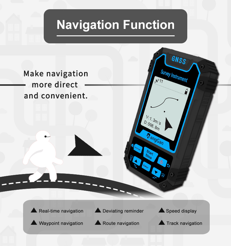
| Function: | Position Navigation Land Measurement |
| Satellite signals: | GPS GLONASS SBAS BeiDou |
| Feature: | Location Finder |
| Waypoint Navigation: | Support |
| Used for: | Agriculture, Lake, Outdoor measuring etc |
| Color: | Blue+Black |
GPS Waypoint Navigation Track Navigation Location Position Finder GPS Land Survey Equipment
Slope Setting Of GPS Land Survey Equipment:
1. In the home screen of the device, press the [Set] button to enter the interface of setting.
2. Please press the [▲][▼] button to move to the option of "Parm. Setting",and press the [Enter] button to enter.
3. After entering the interface of "Parm. Setting", press the [Enter] button to enter "System Setting".
4. After entering the interface of "System Setting",it turns out slope setting, then press the [▲][▼] button to switch on or off.
5. Please press the "Stop" button to exit after setting.
Note:When you need to measure slope,the slope setting should be ON.
Features Of GPS Land Survey Equipment:
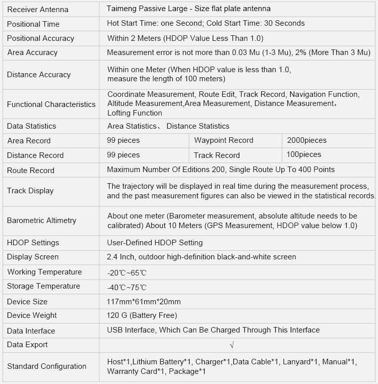
| Parameters | S8 | ||
| Receiver Chip | High Sensitivity GNSS Receiver Chip | ||
| Receiver Antenna | Taimeng Passive Large - Size flat plate antenna | ||
| Positional Time | 3Hot Start Time: one Second; Cold Start Time: 30 Seconds | ||
| Positional Accuracy | Within 2 Meters (HDOP Value Less Than 1.0) | ||
| area Accuracy | Measurement error is not more than 0.03 Mu (1-3 Mu), 2% (More Than 3 Mu) | ||
| Distance Accuracy | )Within one Meter (When HDOP value is less than 1.0, measure the length of 100 meters) | ||
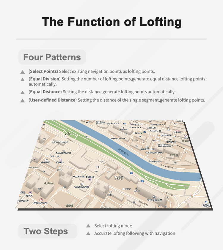
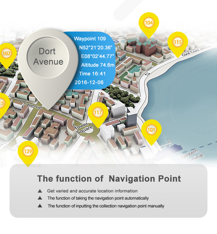
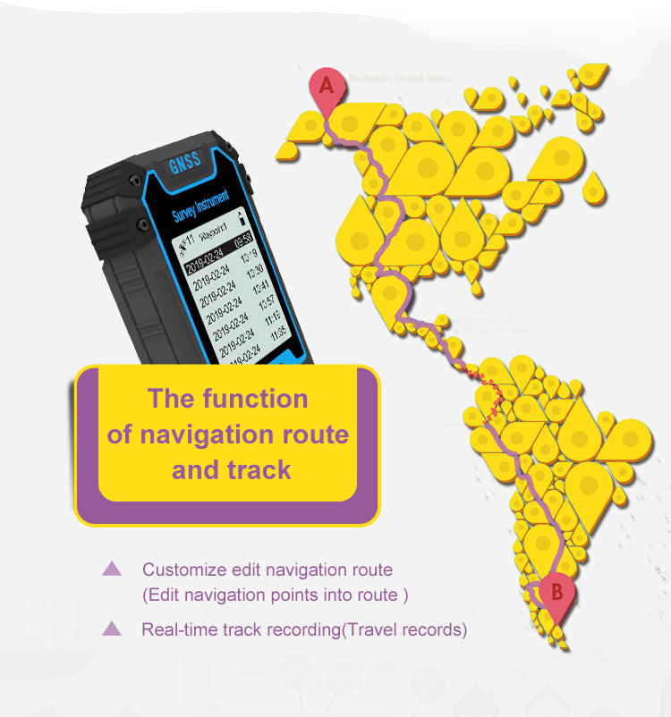
| Functional Characteristics | Coordinate Measurement, Route Edit, Track Record, Navigation Function, Altitude Measurement, | ||
| Area Measurement, Distance Measurement, | |||
| Lofting Function | |||
| Data Statistics | Area Statistics, Distance Statistics | ||
| Area Record | 99 pieces | Waypoint | 2000pieces |
| Distance Record | 99 pieces | Track | 100pieces |
| Route Record | Maximum Number Of Editions 200, Single Route Up To 400 Points | ||
| Track Display | The trajectory will be displayed in real time during the measurement process, and the past measurement figures can also be viewed in the statistical records. | ||
| Barometric Altimetry | About one meter (Barometer measurement, absolute altitude needs to be calibrated) About 10 Meters (GPS Measurement, HDOP value below 1.0) | ||
| HDOP Settings | User-Defined HDOP Setting | ||
| Display Screen | |||
| 2.4 Inch, outdoor high-definition black-and-white screen | |||
| Working Temperature | -20℃~65℃ | ||
| Storage Temperature | -40℃~75℃ | ||
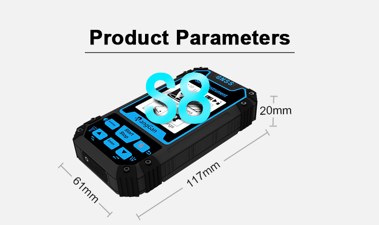
| Device Size | 117mm*61mm*20mm | ||
| Device Weight | 120 G (Battery Free) | ||
| Data Interface | |||
| USB Interface, Which Can Be Charged Through This Interface | |||
| Standard Configuration | Host*1, Lithium Battery*1, Charger*1, Data Cable*1, Lanyard*1, Manual*1, Warranty Card*1, Package*1 | ||


|
