| Sign In | Join Free | My frbiz.com |
|
| Sign In | Join Free | My frbiz.com |
|
| Categories | Survey Grade Handheld GPS |
|---|---|
| Brand Name: | Wanggan |
| Model Number: | S8 |
| Place of Origin: | China |
| MOQ: | 2 |
| Price: | $70-$80 |
| Payment Terms: | T/T, Western Union, MoneyGram |
| Supply Ability: | 10000 sets/month |
| Delivery Time: | 10 working days |
| Packaging Details: | 19*15*9cm 0.4kg |
| Machine Application: | Survey Grade Handheld GPS |
| Battery: | Lithium Battery |
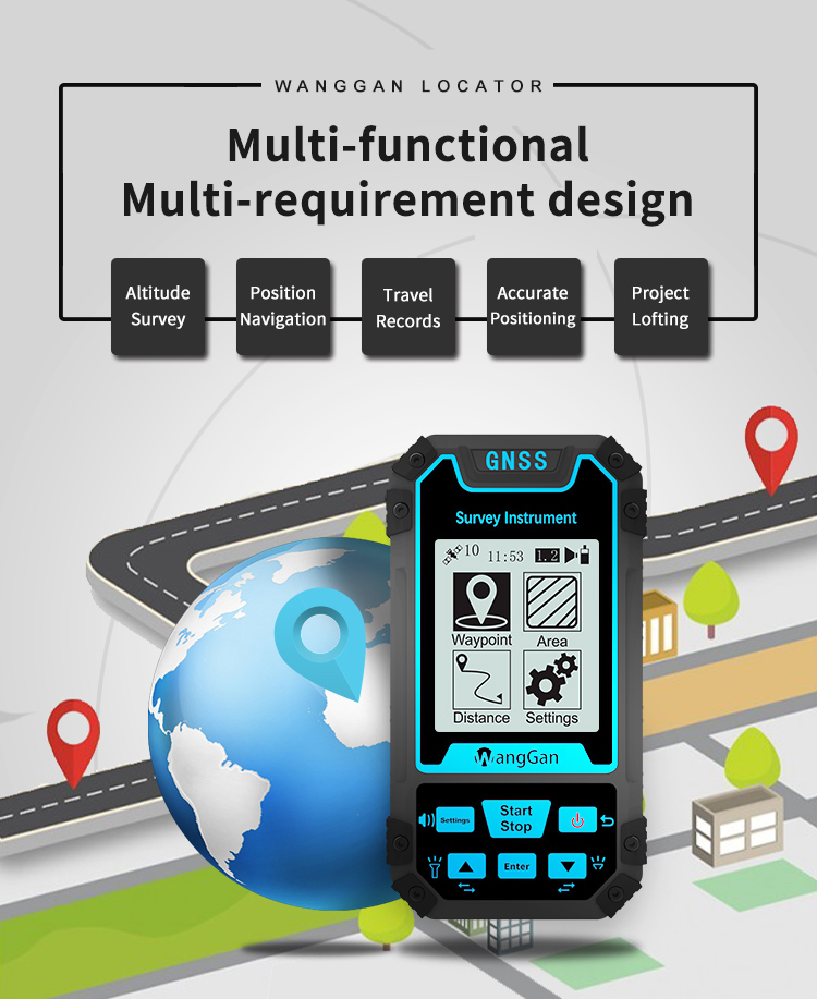
| Function: | Position Navigation Land Measurement |
| Satellite signals: | GPS GLONASS SBAS BeiDou |
| Work temperature: | -20°C~65°C |
| Altitude Survey: | Support |
| Used for: | Agriculture, Lake, Outdoor measuring etc |
| LCD display: | 3.15-inch monochrome |
GPS Land Terrain Multifunctional Accurate Positioning Survey Grade Handheld GPS
Technical Parameters Of Survey Grade Handheld GPS:
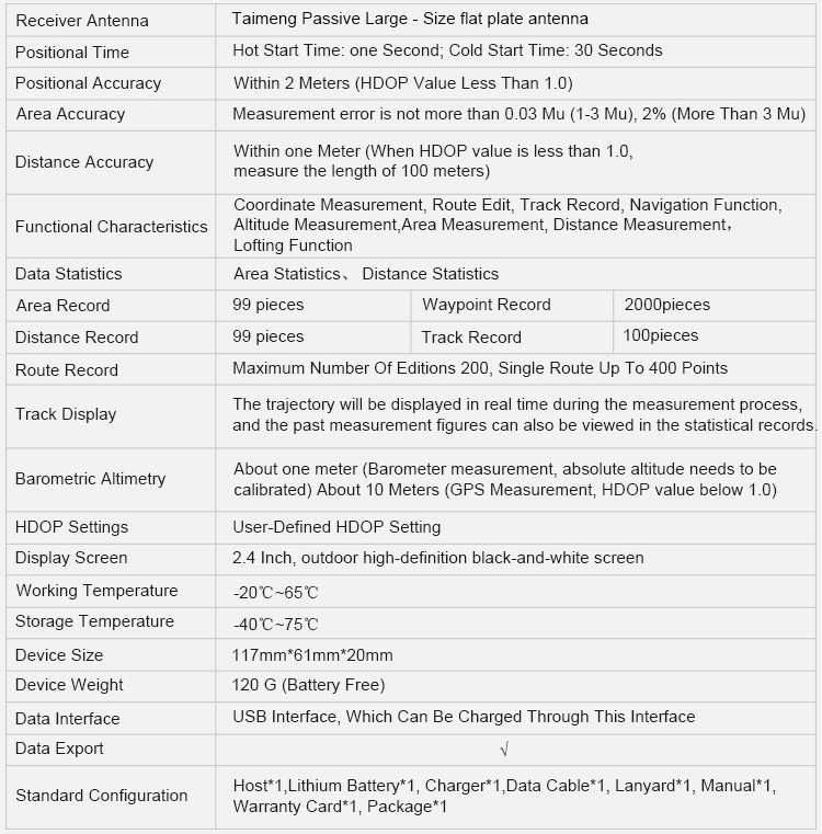
| Receiver Chip | High Sensitivity GNSS Receiver Chip | ||
| Receiver Antenna | Taimeng Passive Large - Size flat plate antenna | ||
| Positional Time | Hot Start Time: one Second; Cold Start Time: 30 Seconds | ||
| Positional Accuracy | Within 2 Meters (HDOP Value Less Than 1.0) | ||
| Area Accuracy | Measurement error is not more than 0.03 Mu (1-3 Mu), 2% (More Than 3 Mu) | ||
| Distance Accuracy | Within one Meter (When HDOP value is less than 1.0, measure the length of 100 meters) | ||
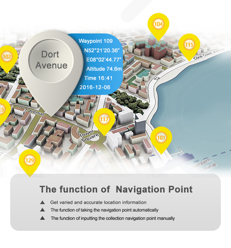
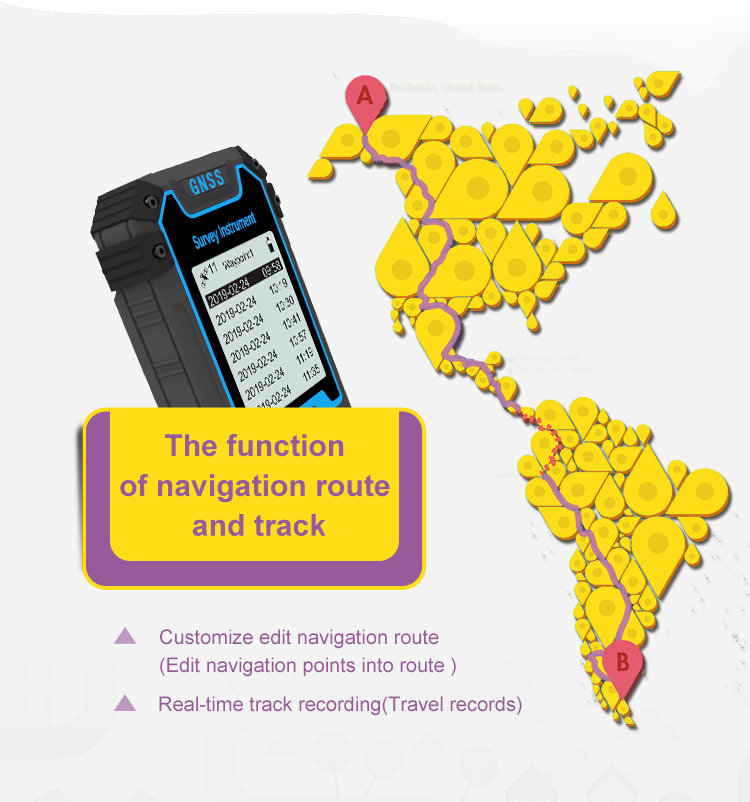
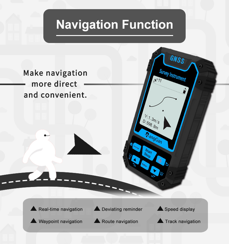
| Coordinate Measurement, Route Edit, Track Record, Navigation
Function, Altitude Measurement, | ||
| Data Statistics | Area Statistics, Distance Statistics | ||
| Area Record | 99 pieces | Waypoint Record | 2000pieces |
| Distance Record | 99 pieces | Track Record | 100pieces |
| Route Record | Maximum Number Of Editions 200, Single Route Up To 400 Points | ||
| Track Display | The trajectory will be displayed in real time during the measurement process, and the past measurement figures can also be viewed in the statistical records. | ||
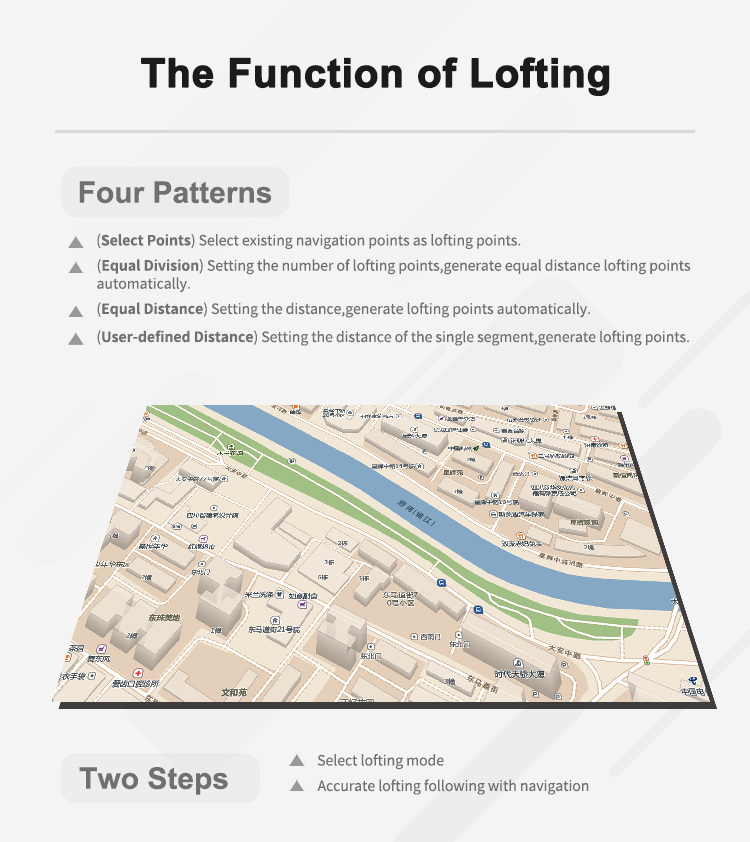
Equal Distance Lofting And Equal Division Lofting Creation:
By setting the number of lofting points or the distance between lofting points to achieve equal or equidistant
1. In the home screen of the device, press the [Setting] button to enter the setting interface.
2. Please press the [▲][▼] button to move to "Route",and press the [Enter] button to enter.
3. After entering the interface of "Route", select to enter "Establish ", select the starting point and end point of the lofting, and press the [Start/ Stop] button to establish a new route.
4. Then select "Lofting Edit" and enter, select the newly established route, press the [Enter] button to enter.
5. Equal Division Lofting, please press the [Enter] button to edit, and then use the [▲][▼] and [Enter] buttons to set the number of lofting points.
6. Equal Distance Lofting, please press the [Enter] button to edit, and then use the [▲][▼] and [Enter] buttons to set the equidistance distance.
7. After the point setting is completed, press the [Start/ Stop] button to create an equal distance lofting. After the creation is completed, press the [Enter] button to save.

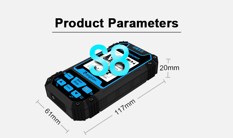

|
