| Sign In | Join Free | My frbiz.com |
|
| Sign In | Join Free | My frbiz.com |
|
| Categories | GPS Measuring Tool |
|---|---|
| Brand Name: | WangGan |
| Model Number: | S4 |
| Place of Origin: | China |
| MOQ: | 2 |
| Price: | $78-$85 |
| Payment Terms: | T/T, Western Union, MoneyGram |
| Supply Ability: | 10000 sets/month |
| Delivery Time: | 8 working days |
| Packaging Details: | 19*15*9cm 0.4kg |
| Product Type: | GPS Measuring Tool |
| Use range: | Farmland, Pond Or Lake, Outdoor Survey etc |
| Mountain measurement: | Support |
| Data Export: | Support |
| Application: | Flat, Slope, Mountain Distance Area Measurement |
| Package size: | 19*15*9cm |
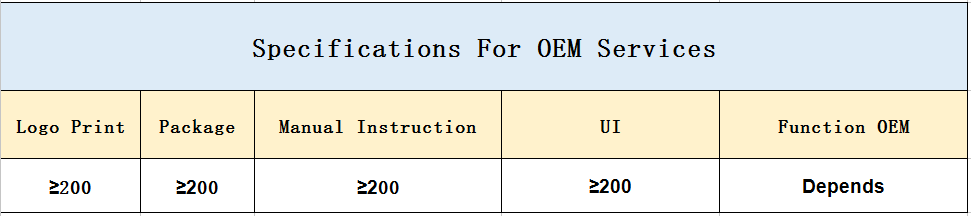
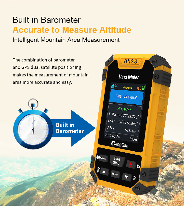
| Color Screen: | Yes |
| Feature: | Handheld GPS Survey Equipment |
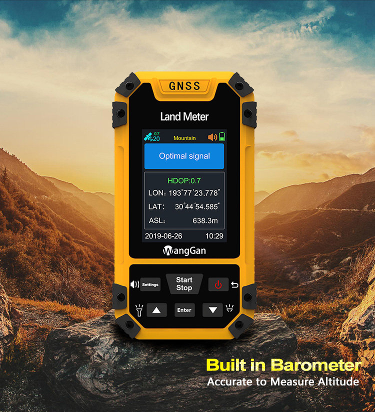
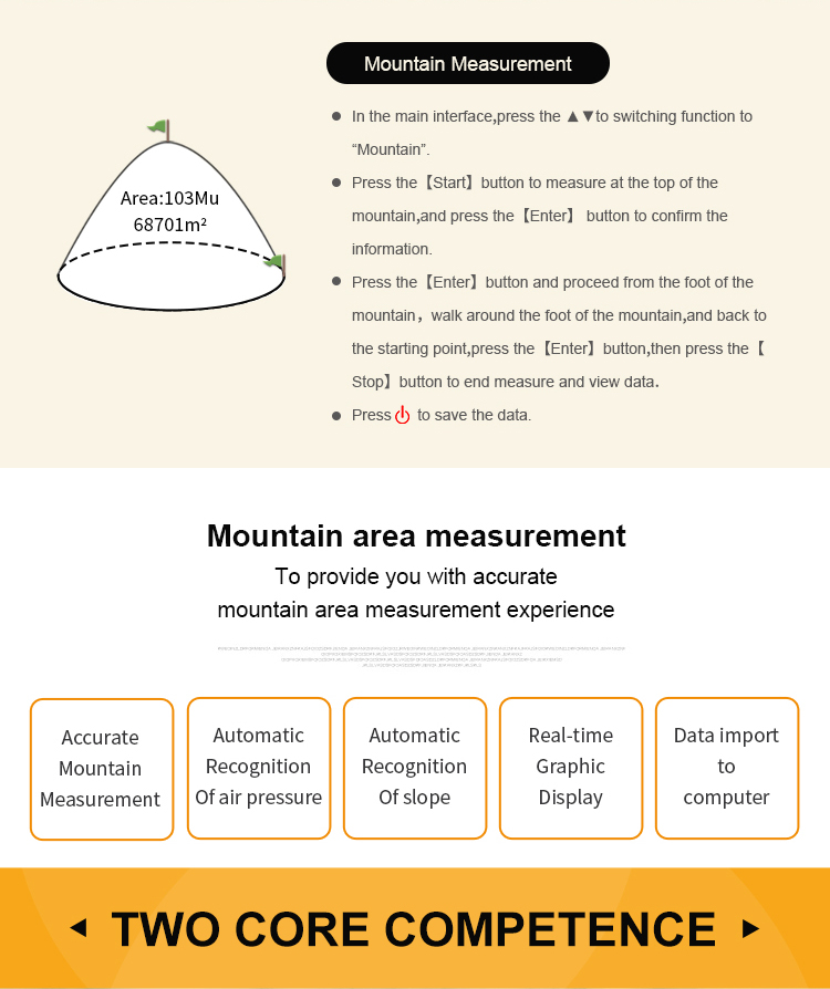
GPS Accurate Mountain Measurement Automatic Recognition Of Slope Data Export GPS Measuring Tool
Fixed Point Measurement Of GPS Land Survey Equipment:
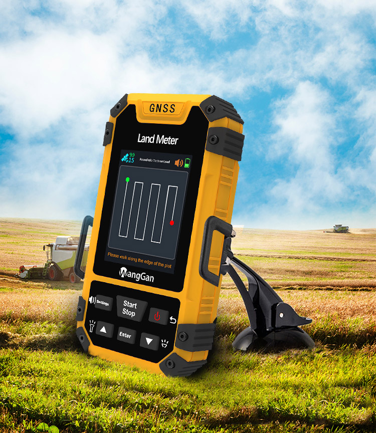
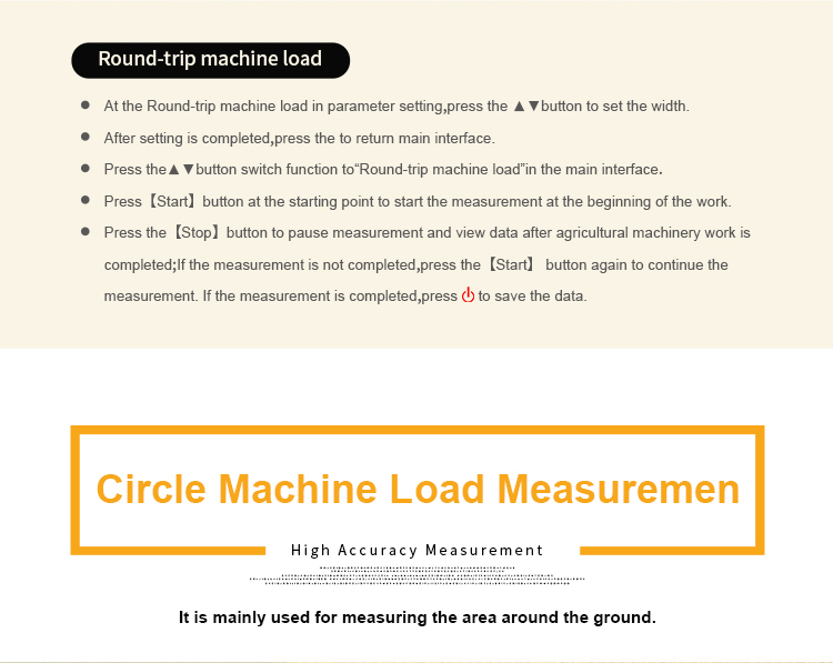
① In the main interface,press the ▲▼to switching function to“Fixed point”.
② At the land starting point,press the【Start】button to start measuring,and press the 【Enter】 button to confirm the information of the starting point.
③ Walk along the edge of the land,press the 【Enter】button at each inflection point to collect the information of each inflection point;
④ After collecting the information of the last inflection point (not coinciding with the starting point),press【Stop】button to pause the measurement and view the data.
⑤ If the measurement is not completed,press the【Start】button again to continue the measurement. If the measurement is completed,press "Stop" to save the data.
Product Function Of GPS Measuring Tool:
| Altitude display | √ |
| Altitude measurement | √ |
| Track display | √ |
| Mu setting | √ |
| Unit setting | √ |
| Time display | √ |
| Data statistics | √ |
| Historical record | √ |
| Lighting /Currency detection | √ |
| Dry battery | √ |
| lithium battery | √ |
| Data storage | 200 |
| Voice broadcast | √ |
| Data export | √ |


| Functions | S4 |
| Positioning accuracy | 2.5m |
| Initial barometric calibration | √ |
| Normal area measurement | √ |
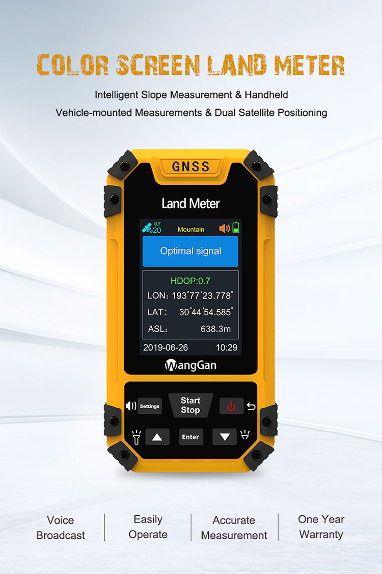
| Mountain area measurement | √ |
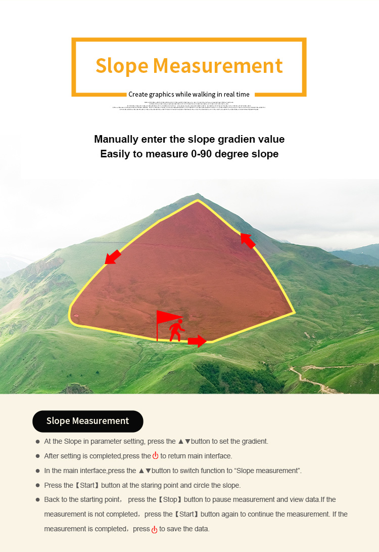
| Intell. Slope measurement | √ |
| Fixed point measurement | √ |
| Fixed width area measurement | √ |
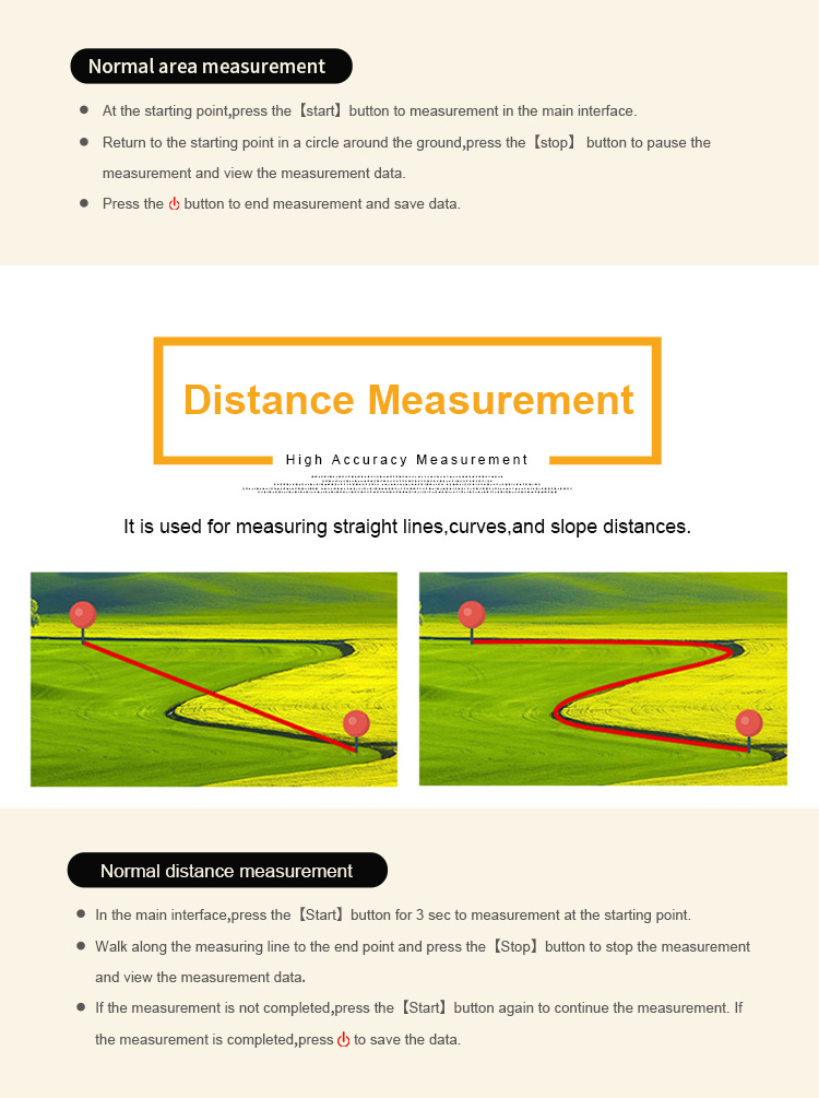
| Normal distance measurement | √ |
| Manual distance measurement | √ |
| Altitude display | √ |
| Altitude measurement | √ |
| Track display | √ |
| Mu setting | √ |
| Unit setting | √ |
| Time display | √ |
| Data statistics | √ |
| Historical record | √ |
| Lighting /Currency detection | √ |
| Dry battery | √ |
| lithium battery | √ |
| Data storage | 200 |
| Voice broadcast | √ |
| Data export | √ |

|
