| Sign In | Join Free | My frbiz.com |
|
| Sign In | Join Free | My frbiz.com |
|
| Categories | Handheld GPS Survey Equipment |
|---|---|
| Brand Name: | Wanggan |
| Model Number: | S8 |
| Certification: | ISO 9001 |
| Place of Origin: | China |
| MOQ: | 2 |
| Price: | $70-$80 |
| Payment Terms: | T/T, Western Union, MoneyGram |
| Supply Ability: | 10000 sets/month |
| Delivery Time: | 8 working days |
| Packaging Details: | 19*15*9cm 0.4kg |
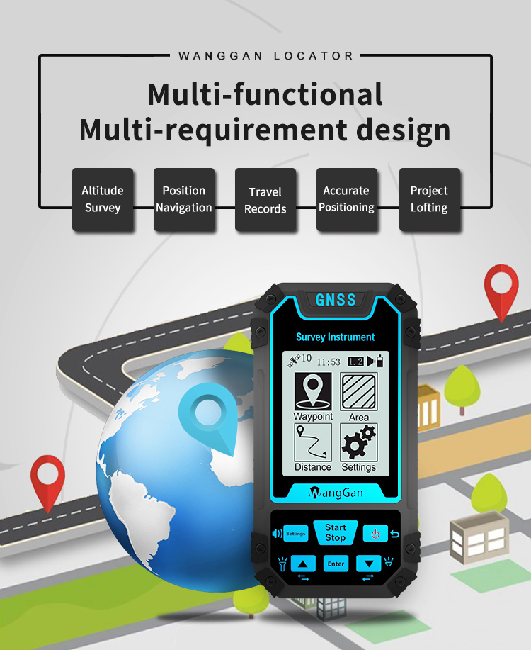
| Machine name: | HandHeld GPS Survey Equipment |
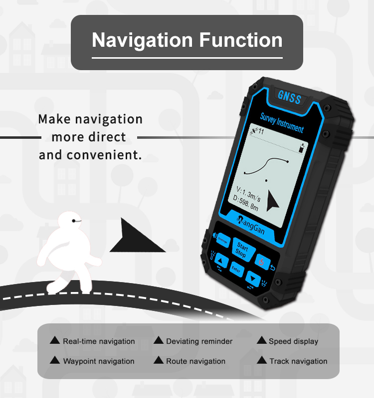
| Function: | Position Navigation Land Measurement |
| Satellite signals: | GPS GLONASS SBAS BeiDou |
| Feature: | Location Finder |
| Use range: | Altitude survey, Position navigation etc |
| Used for: | Agriculture, Lake, Outdoor measuring etc |
| Battery: | Lithium Battery |
| Data Interface: | USB Interface |
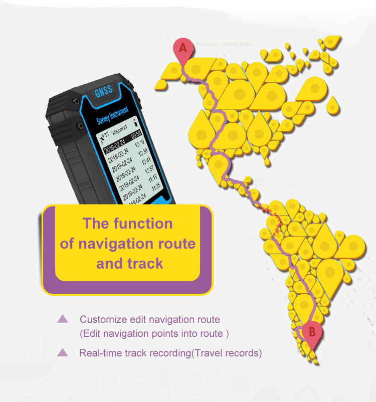
| Route Edit: | Support |
| Keyword: | GPS measuring tool |
HandHeld GPS Survey Equipment Agriculture Geogragh Land Surveying Equipment
Product Parameters of Handheld GPS Survey Equipment:
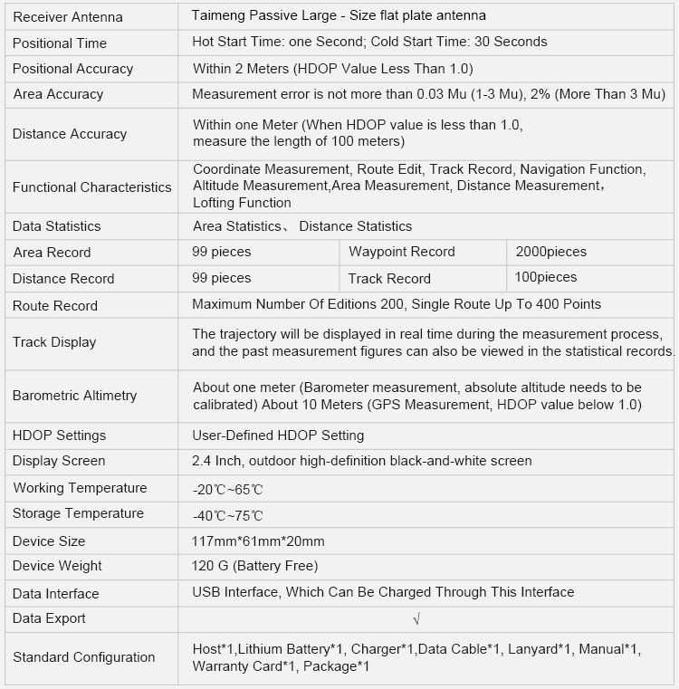
| Receiver Antenna | Taimeng Passive Large - Size flat plate antenna | ||
| Positional Time | Hot Start Time: one Second; Cold Start Time: 30 Seconds | ||
| Positional Accuracy | Within 2 Meters (HDOP Value Less Than 1.0) | ||
| Area Accuracy | Measurement error is not more than 0.03 Mu (1-3 Mu), 2% (More Than 3 Mu) | ||
| Distance Accuracy | Within one Meter (When HDOP value is less than 1.0 measure the length of 100 meters) | ||
| Functional Characteristics | Coordinate Measurement, Route Edit, Track Record, Navigation Function,Altitude Measurement,Area Measurement, Distance Measurement,Lofting Function | ||
| Data Statistics | Area Statistics, Distance Statistics | ||
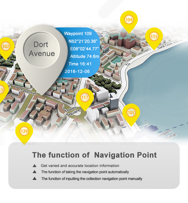
| Area Record | 99 pieces | Waypoint Record | 2000pieces |
| Distance Record | 99 pieces | Track Record | 100pieces |
| Route Record | Maximum Number Of Editions 200, Single Route Up To 400 Points | ||
| Track Display | The trajectory will be displayed in real time during the measurement process,and the past measurement figures can also be viewed in the statistical records. | ||
| Barometric Altimetry | About one meter (Barometer measurement, absolute altitude needs to be calibrated) About 10 Meters (GPS Measurement, HDOP value below 1.0) | ||
| HDOP Settings | User-Defined HDOP Setting | ||
| Display Screen | 2.4 Inch, outdoor high- definition black-and-white screen | ||
| Working Temperature | -20"C ~65"C | ||
| Storage Temperature | -40"C~75"C | ||
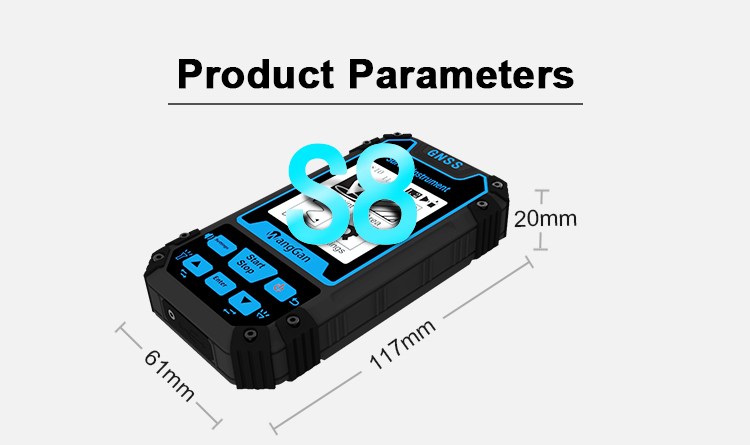
| Device Size | 117mm*61mm*20mm | ||
| Device Weight | 120 g (Battery Free) | ||
| Data Interface | USB Interface, Which Can Be Charged Through This Interface | ||
| Data Export | √ | ||
| Standard Configuration | Host*1,Lithium Battery* 1, Charger*1,Data Cable*1, Lanyard*1, Manual*1,Warranty Card*1, Package*1 | ||
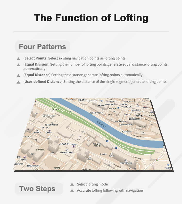
The Function of Lofting:
Four Patterns:
1. (Select Points) Select existing navigation points as lofting points.
2. (Equal Division) Setting the number of lofting points,generate equal distance lofting points automatically.
3.(Equal Distance) Setting the distance,generate lofting points automatically.
4. (User-defined Distance) Setting the distance of the single segment,generate lofting points.

|
