| Sign In | Join Free | My frbiz.com |
|
| Sign In | Join Free | My frbiz.com |
|
| Categories | GPS Measuring Tool |
|---|---|
| Brand Name: | Wanggan |
| Model Number: | S2 |
| Certification: | ISO 9001 |
| Place of Origin: | China |
| MOQ: | 2 |
| Price: | $70-$80 |
| Payment Terms: | T/T, Western Union, MoneyGram |
| Supply Ability: | 10000 sets/month |
| Delivery Time: | 8 working days |
| Packaging Details: | 18*14*8cm 0.4kg |
| Product type: | GPS Measuring Tool |
| Keyword: | GPS land survey equipment |
| Used for: | Land Slope Mountain Measuring |
| Feature: | Land Distance Area Measuring |
| OEM: | Support |
| Satellite signals:: | GPS GLONASS SBAS BeiDou |
| Color: | Yellow+Black |
| Used range: | Farmland, Pond, Outdoor measuring etc |
| weight: | 120g |
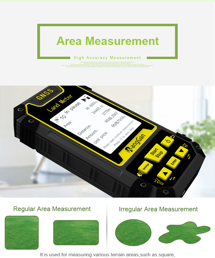
GPS land survey instrument GPS land Meter land area distance GPS Measuring Tool
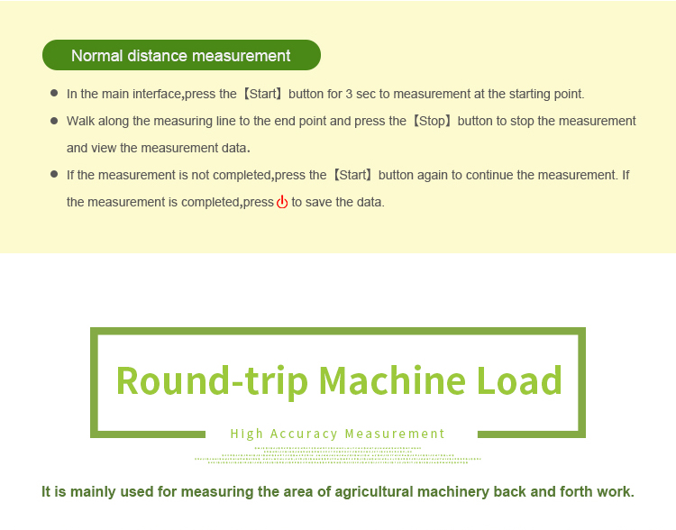
Normal distance measurement:
1. In the main interface,press the [Start] button for 3 sec to measurement at the starting point.
2. Walk along the measuring line to the end point and press the [Stop] button to stop the measurement and view the measurement data.
3. If the measurement is not completed,press the [Start] button again to continue the measurement. If the measurement is completed,press
power button to save the data.
Slope Measurement:
1. At the Slope in parameter setting, press the [▲/▼] button to set the gradient.
2. After setting is completed,press the d to return main interface.
3. In the main interface,press the [▲/▼] button to switch function to "Slope measurement".
4. Press the [ Start] button at the staring point and circle the slope.
5. Back to the starting point, press the I Stop ] button to pause measurement and view data.If the measurement is not completed, press the [
Start] button again to continue the measurement.
6. If the measurement is completed, press power button to save the data

|
