| Sign In | Join Free | My frbiz.com |
|
| Sign In | Join Free | My frbiz.com |
|
| Categories | GPS Land Meter |
|---|---|
| Brand Name: | Wanggan |
| Model Number: | S4 |
| Certification: | ISO9001 |
| Place of Origin: | China |
| MOQ: | 2 pieces |
| Payment Terms: | T/T, Western Union, MoneyGram |
| Supply Ability: | 10000 pieces/month |
| Delivery Time: | 7 working days |
| Packaging Details: | 18*14*8cm.0.4kg |
| Usage: | GPS land Meter |
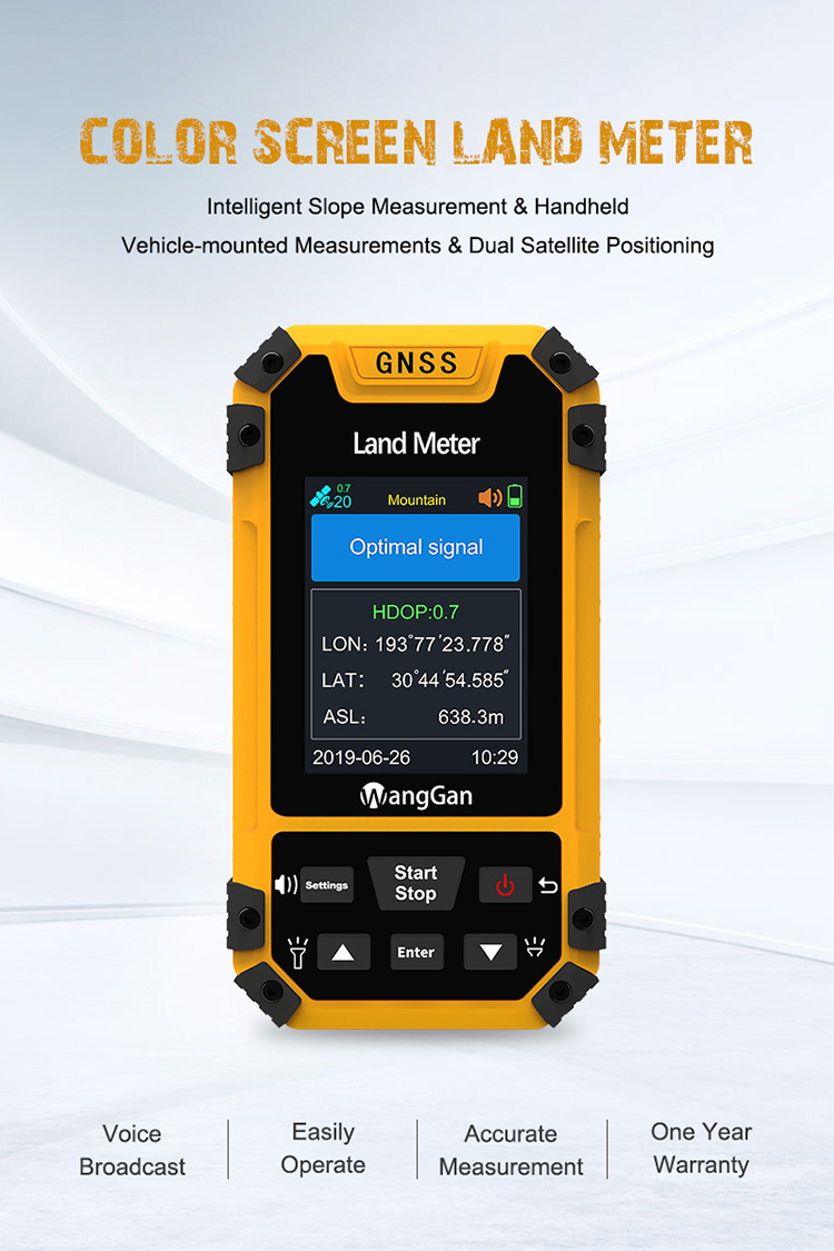
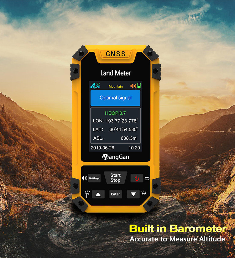
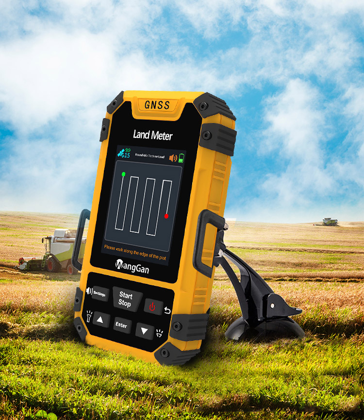
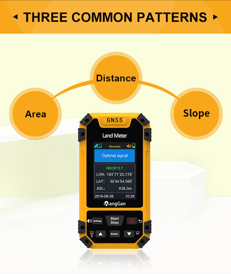
| Product name: | Handheld GPS Survey Equipment Mountain Slope Flat Land Measurement High Accuracy Land Measuring Device |
| Satellite signals: | GPS GLONASS SBAS BeiDou |
| Keyword: | GPS Land Measuring Tools |
| Work temperature: | -20°C~65°C |
| Storage temperature: | -40°C~75°C |
| Battery: | Lithium Battery |
| Weight: | 120g(NO battery) |
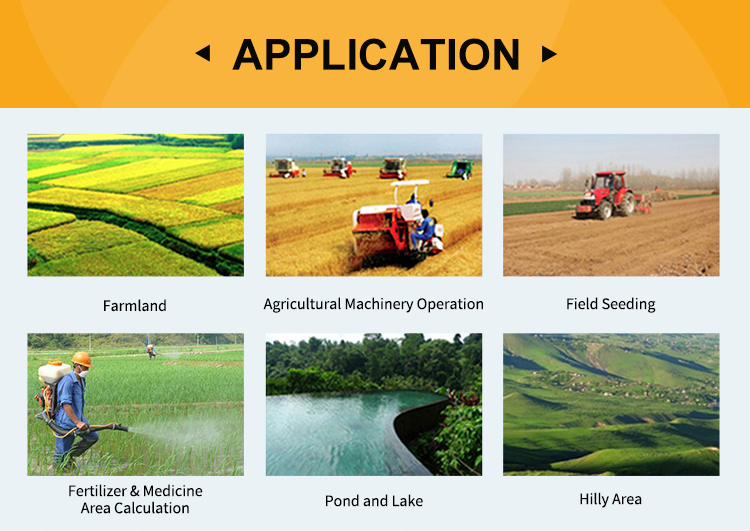
| Application: | GPS Land Surveying Equipment |
| LCD display: | 3.15-inch Color display |
Handheld GPS Survey Equipment Mountain Slope Flat Land Measurement High Accuracy Land Measuring Device
① On the home page of boot,press the▲▼button to switch measurement mode;
② On the home page of boot,press the【Enter】button to view the current measurement mode and the parameter setting.
① Turn on the land meter in an open field;
② After started up,it needs to search for signal;There are voice prompts,text prompts,signal state and HDOP value on the screen;It is recommended to start measuring when the HDOP value is below 1.0.
③ After finishing searching for signal,it can start measuring according to function demands.
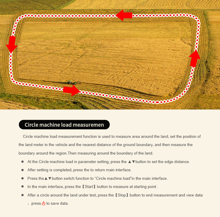
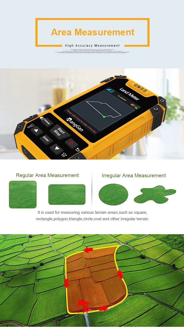
① At the starting point,press the【start】button to measurement in the main interface.
② Return to the starting point in a circle around the ground,press the【stop】 button to pause the measurement and view the measurement data.
③ Press the "Start" button to end measurement and save data.
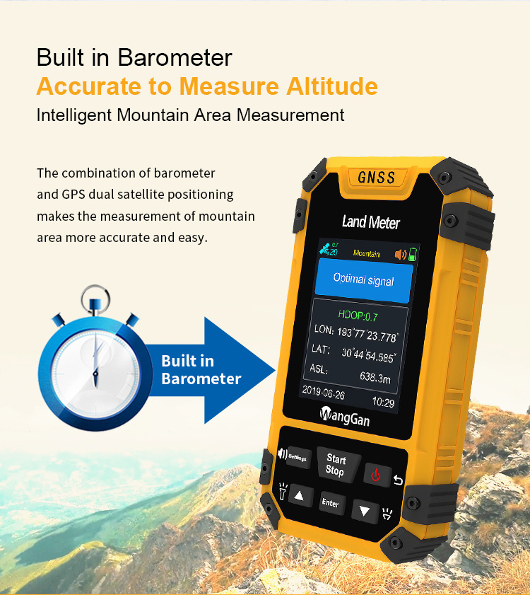
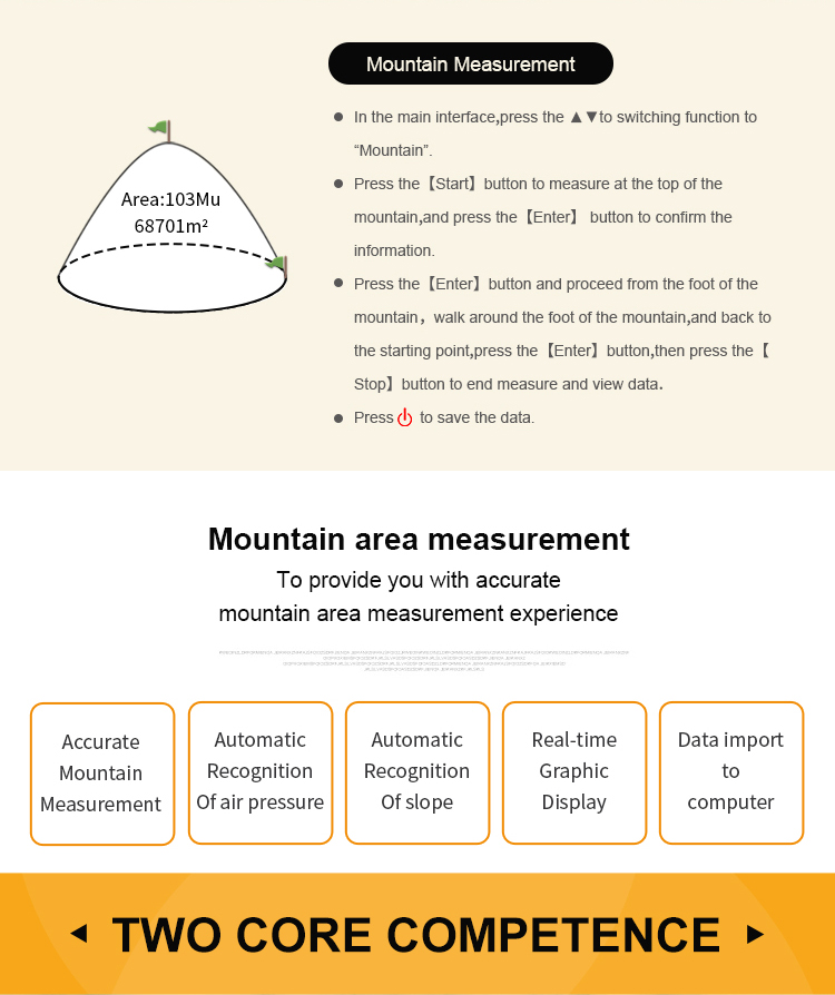
• Mountain area measurement (just for S4)
① At the starting point,press the ▲▼to switch function to “Mountain”mode in the home interface;
② Press the 【Start】button to measure at the top of the mountain,then press the 【Enter】 button to confirm the information.
③ Press the【Enter】button and proceed from the foot of the mountain,walk around the foot of the mountain,and back to the starting point,press the【Enter】button,then press the【Stop】button to end measure and view data;
④ press "Start" to save the data.
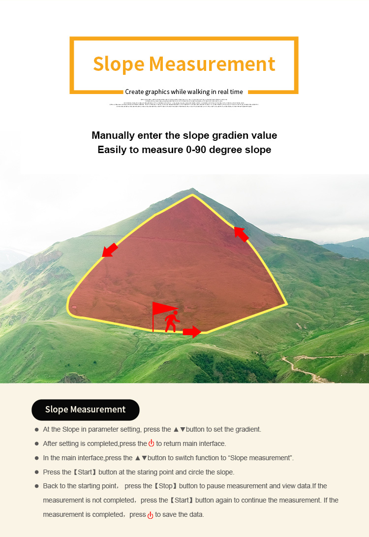
• Intelligent slope measurement
The way of measuring is similar to normal area measurement.(please refer to normal area measurement method)


|
