| Sign In | Join Free | My frbiz.com |
|
| Sign In | Join Free | My frbiz.com |
|
| Categories | GPS Measuring Tool |
|---|---|
| Brand Name: | Wanggan |
| Model Number: | S4 |
| Certification: | ISO9001 |
| Place of Origin: | China |
| MOQ: | 2 pieces |
| Payment Terms: | T/T, Western Union, MoneyGram |
| Supply Ability: | 10000 pieces/month |
| Delivery Time: | 7 working days |
| Packaging Details: | 18*14*8cm.0.4kg |
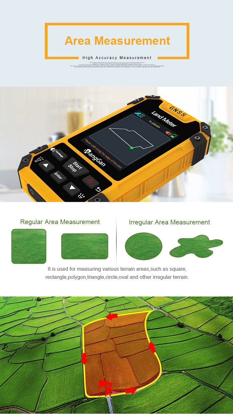
| Application: | GPS Land Measuring Tool |
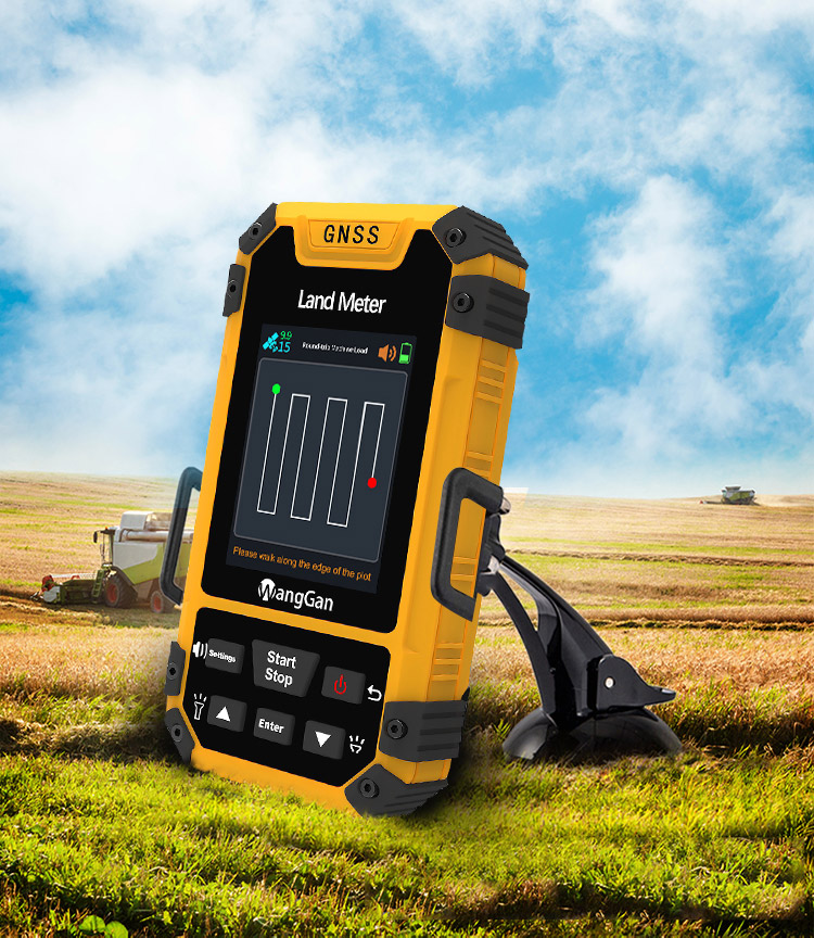
| LCD display: | 3.15-inch Color display |
| Function: | GPS Multifunctional measurement |
| Satellite signals: | GPS GLONASS SBAS BeiDou |
| Keyword: | GPS Land Measuring Tools |
| Work temperature: | -20°C~65°C |
| Storage temperature: | -40°C~75°C |
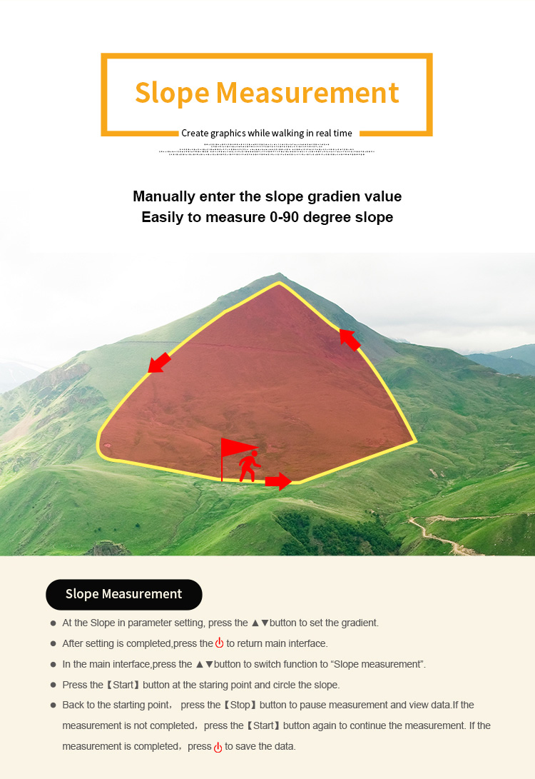
| Use range: | slope, mountain and flat terrain |
| Battery: | Lithium Battery+AAA battery |
| Product title: | GPS Survey Equipment Mountain And Slope Measurement High Accuracy Land GPS Measuring Tool |
GPS Survey Equipment Mountain And Slope Measurement High Accuracy Land GPS Measuring Tool
① On the home page of boot,press the 【Settings】button to enter the settings interface;
② Press the▲▼button move to“System setting”;Press the【Enter】button to enter;
③ Press the【Enter】button to the altitude;
④ Press ▲▼ button to choose GPS or barometer;
⑤ After finishing setting,press thebutton to exit.
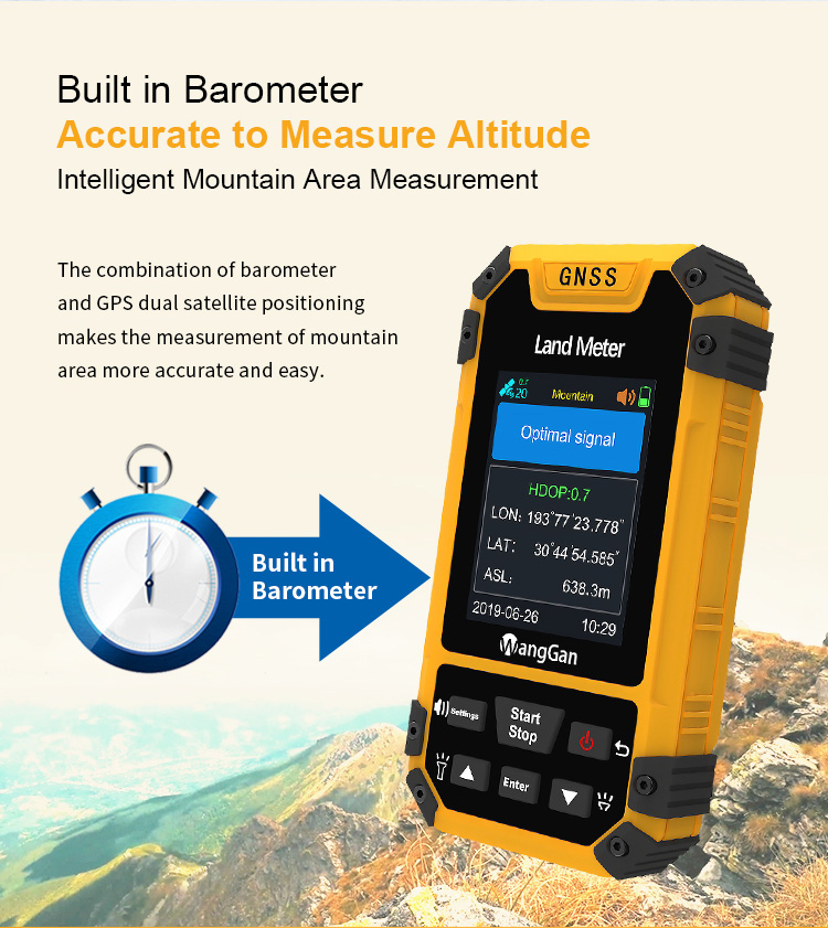
Note: if you choose the barometer, you need to calibrate the height. The measurement is more accurate after calibration.
① On the home page of boot,press the 【Settings】button to enter the settings interface;
③ Press ▲▼ button to adjust the value of number;
④ After finishing setting,press the![]() button to exit.
button to exit.
• Data record
• Statistics record
① On the home page of boot,press the 【Settings】button to enter the settings interface;②Press the▲▼button move to“Data record”;Press the【Enter】button to enter;
③ Press ▲▼ button to “Statistics record”,then press the【Enter】button to enter;
④ Press ▲▼ to choose area or distance in the data record interface;
⑤ Press 【Enter】button can delete the data.
① On the home page of boot,press the 【Settings】button to enter the settings interface;
② Press the▲▼button move to“Data record”;Press the【Enter】button to enter;
③ Press ▲▼ button to “Measuring record”,then press the【Enter】button to enter;
④ Press ▲▼ to select a record in the measuring record interface;
⑤ Press the【Enter】button to view detailed data information;
⑥ Press the 【Settings】button can view the graphic display.(Press 【Enter】button can delete the data.)
① On the home page of boot,press the【Settings】button to enter the settings interface;
② Press the▲▼button move to“Factory reset”;Press【Enter】to factory reset interface;
③ Press the▲▼button to select "Yes" ;
④ Press【Enter】to restore the factory settings.
Note: restore the factory settings will clear all measuring data and parameter setting.


|
